Evidence, Forensics & Archaeology
Law Enforcement, Archaeologists, Cemetery Mapping
Geo-Scan uses an advanced HyperStacking technology, which provides excellent near-surface resolution and increased depth penetration in most soil types.
Whether the goal is landscape-scale site mapping, excavation planning, locating forensic targets, or sensitive cultural resources, GEO-SCAN is ready to meet your Archaeologists and forensic needs as a key tool for non-invasive investigations.
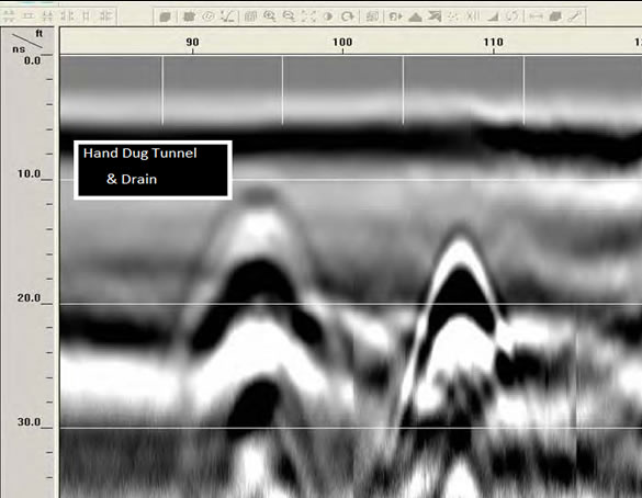
Archaeologists: GPR is vital to investigate and protect cultural resources and artifacts. This includes mapping unmarked graves and site assessments prior to construction activities, along with 3D rendering and molding.
Cemetery Mapping Many historical and more recent cemeteries contain unmarked graves. This is usually a byproduct of fallen and/or relocated grave markers, though in some cases there may never have been a stone or other marker. Unmarked graves are also common to historical landscapes, battlefields, and crime scenes. Geo-Scan uses advanced ground penetrating radar as a high-resolution and non-invasive method for finding these burial sites, along with geometrical patterning in 3D.
Post Processing Services
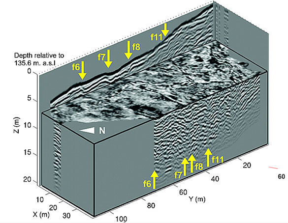
GEO-Scan uses RADAN® 7, GSSI’s state-of-the-art GPR post-processing software. A powerful and versatile software platform, and excels at processing 2D GPR profiles and creating 3D time slice datasets.
Post-processing GPR data is a critical component of surveys, that need more detail and when you need to see or show your client in a exactly what’s in the ground.
- 2D and 3D data for enhanced analysis
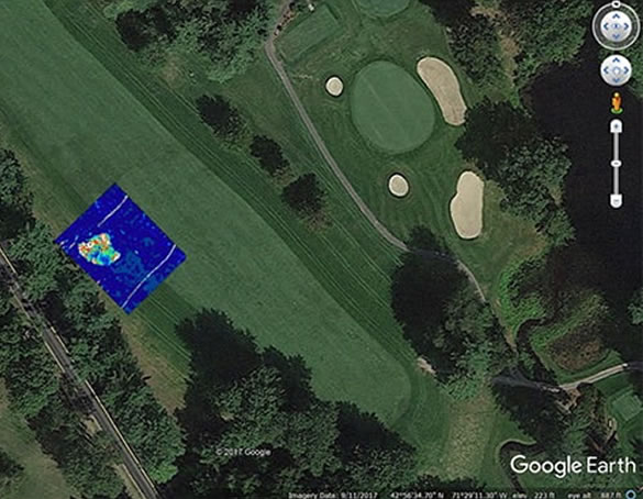
- Google Earth exported for easy use and share
- GPS mapped and abled to be seen and recreated
- 3D time slices showing an approximation pf depth.
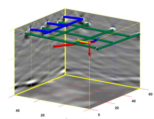
- Multiple export methods and AutoCAD Target output – seamless output of interpreted data results to AutoCAD


